
|

|
KBR / LRTCEmergency
|
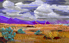 Image by Kikumasa
|
| WEATHER and WILDFIRE LINKS |
Current Weather
|
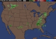
National Watches
| National Thunderstorm Potential
|

|
|
|
|
|
KBR / LRTCEmergency
|
Image by Kikumasa
|
| WEATHER and WILDFIRE LINKS |
Current Weather
|
National Watches
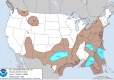
| National Thunderstorm Potential
|
|
|
