Least Resistance Training Concepts
(LRTC)

Volunteers Training for Emergencies

E
  LRTC Emergency Response Team
INFORMATION SHEET

How to Use GIS Mapping Information
During Evacuations at Wide-area Emergencies

Updated October 29, 2019

This information sheet is primarily intended for persons associated with or working with the LRTC Technical Large Animal Rescue and Evacuation Team, however this information may be useful to other groups or private individuals who may wish to similarly prepare their own rescue teams.

THIS INFORMATION SHEET IS A GUIDELINE. There may be some mapping variations among jurisdictions.

THE ISSUE

What we never want to do during an evacuation operation is to get lost within an emergency zone. Maps are critical tools, especially when operating in unfamiliar areas. In past years teams were provided with paper maps, often run off a copier. Today, tablets and GIS mapping capabilities can provide us with much more information and we can often "zoom in" for greater detail. Even printed maps provided at Staging Areas and Base Camps are now often more sophisticated and provide more information.

Not all the information provided with these mapping platforms is of interest to evacuation teams, however it is beneficial to be familiar with the common symbols and indicators currently used to recognize what elements are important and what elements can be disregarded.

Maps of wide area emergencies typically illustrate the current boundaries of the emergency and include references known as point symbols. Evacuation responders should take notice of some point symbols, such as those referring to Staging Areas, Base Camps, Safety Zones, First Aid Stations, etc., as well as active fire fronts where risks are greater and aircraft may be operating at low levels.

USING THE MAPS

Presented below are relevant excerpts from an introduction module for understanding GIS mapping symbols.

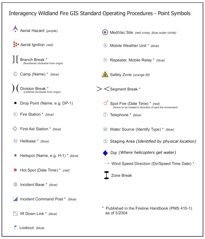
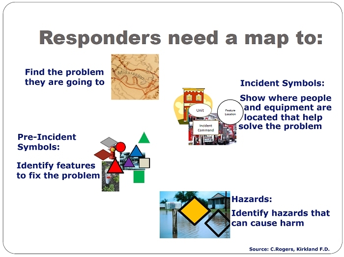
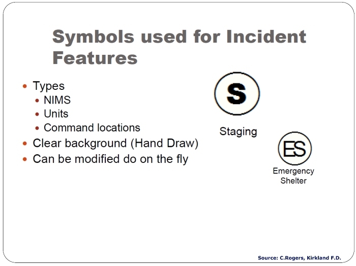
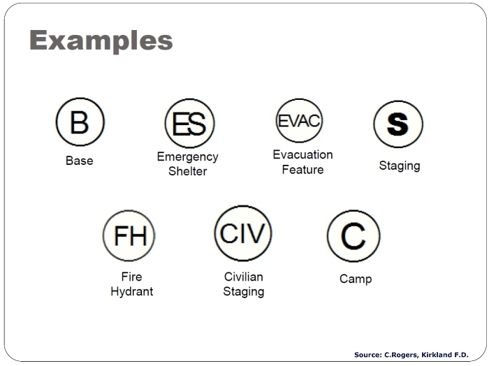
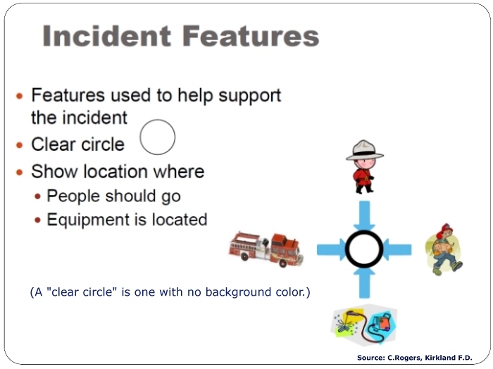
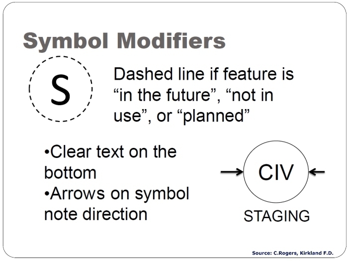
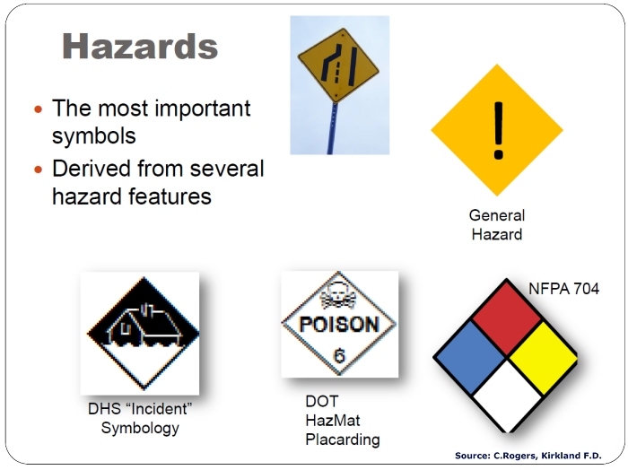
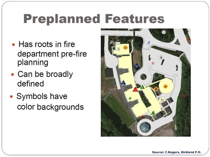
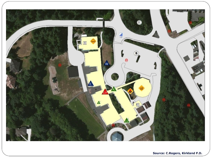
If provided with maps at an emergency event, or if downloading maps using a tablet, we must recognize critical symbols for both operational safety and to fully understand the locations where we have been assigned to perform tasks. Responder accountability is critical during emergency events, and Incident Commanders need to have confidence that all responders are operating safely and are in areas where they have been assigned.

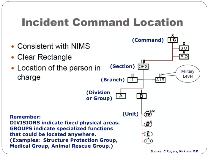
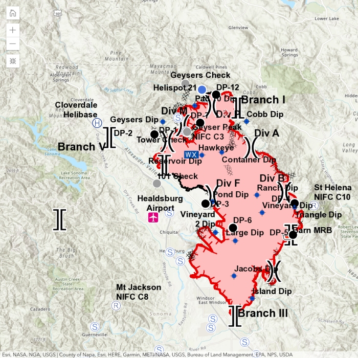
Note: Branches and Divisions often have gaps in their sequences to allow for additional branches and groups to be inserted as the fire expands. For example, in the early stages a fire may have Divisions A (Alpha), M (Mike), Q (Quebec) and Z (Zulu). As the fire expands, more units arrive and the span of control has to be adjusted, additional divisions will be initiated with letters that fall within the sequential order. When the numbers of divisions exceed the recommended span of control, branches will be formed to supervise a reasonable number of divisions, often with "skips" between their numbers in the event additional branches are later required. Example: Branch I, Branch III, Branch V.

Here is another view of a map of the Kincade Fire (Sonoma County, CA.) After reviewing this Information Sheet, the map should now make a great deal more sense.


For a more complete discussion on this subject, please visit the NAPSG Foundation.


Return to Information Sheets and Resource Guides

Return to Sample Incident Responses

Return to LRTC TLAR / EVAC Page

The training information presented in these information sheets and guides is offered for illustrative and volunteer refresher purposes only. It is not a substitute for actual hands-on training.

Press Back to return to the page which brought you here

Return to LRTC Wild Horse Mentors

Return to KBR Training Page

Go To KBR Horse Net